Co-Operative Environments
ecologies of subtraction and addition as an automated urban protocolDiploma thesis, 2019-2020, Glasgow School of Art, unifinished due to Covid-19 pandemic
1 Context
With runaway climate change underway, Glasgow School of Art has decided to situate Diploma Thesis works of 2019-2020 in Antwerp, Belgium (fig 01). It is a city with blurred edges, resulting from using construction land as “an abundant consumable commodity”, a carbon form inseparable from overconsumption of fossil fuels.
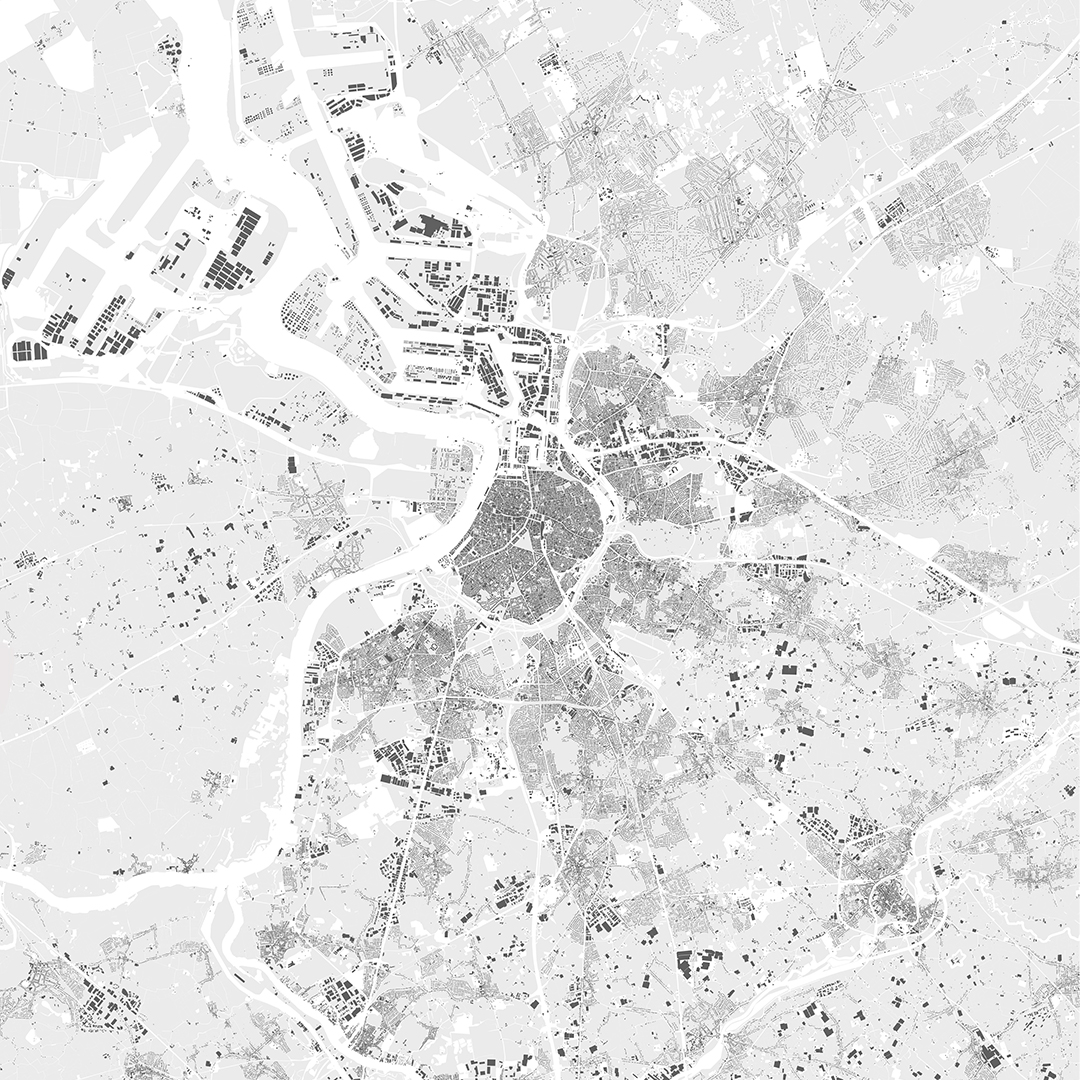
Fig 01. Built environment of Antwerp
Such approach is proven to be unsustainable, but ruling capitalist hegemony limits urban policies to gentrification. Currently, there is no alternative to capitalist development, with real estate logic fully embraced by city’s planners (fig 02).
0 Primary development is into the sprawl
1-3 Areas of the city that have been renewed through gentrification
4-5 New developments on post-industrial landscape
A - North Antwerp is facing immense pressure from gentrification, being the last neighbourhood withing the ring
B - extents of the proposed Ringland
C - 20th century rayons
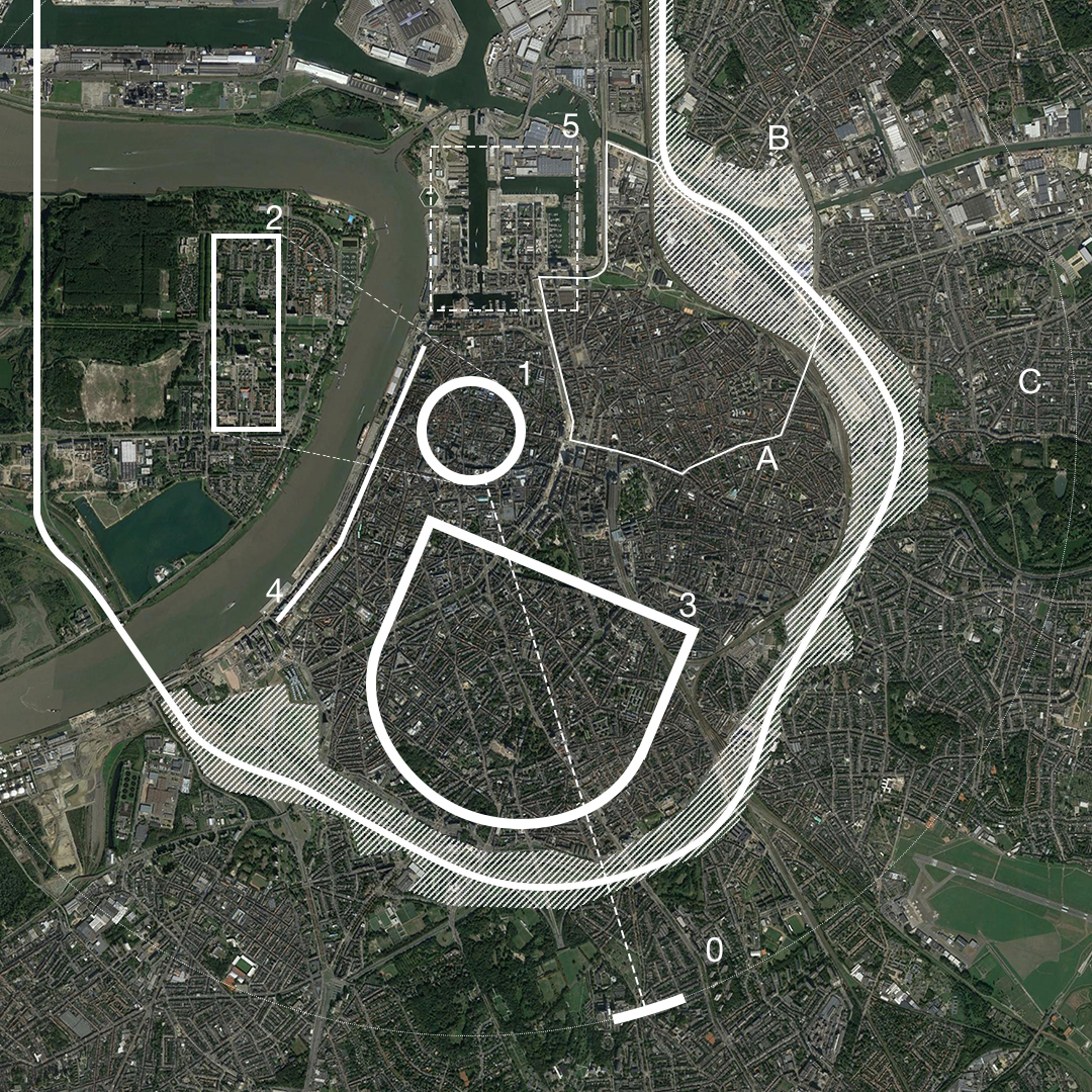 Fig 02. Development of Antwerp
Middle class residents are attracted to the gentrifying inner city, while the sprawl grows as a financially viable alternative to the rest. Both movements are a part of the same process caused by the lack of mitigating planning policies.
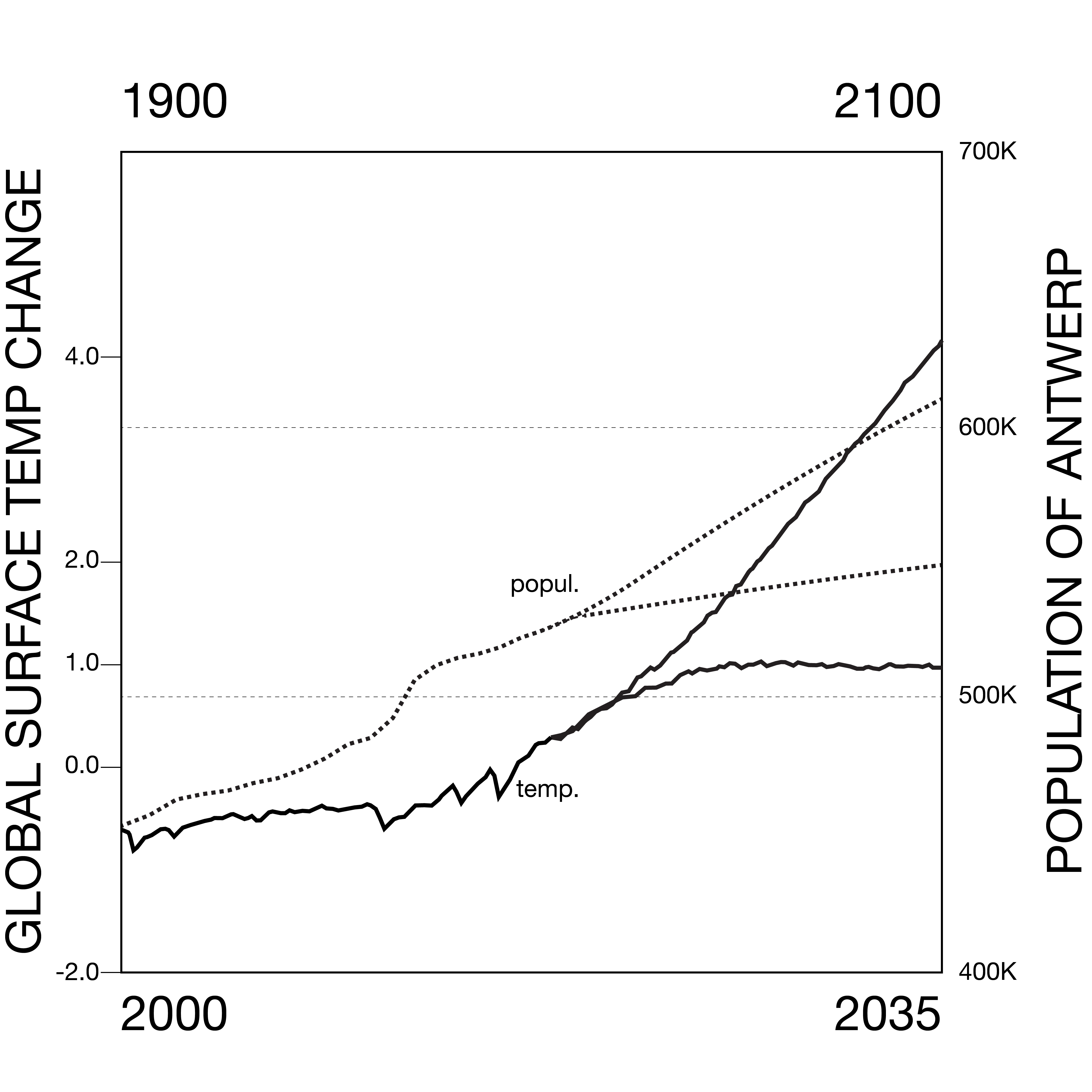
Fig 03. Projected population movement for Antwerp 2000-2035 and projected temperature increase 1900-2100
Such development is further stimulated by ongoing population increase, putting the current mode of producing built environment in Antwerp directly at odds with achieving goal of mitigating temperature increase.
Urban sprawl is a repetitive spatial product, the scale of which cannot be addressed through a singular intervention. It also embodies ideological principles of private ownership, overconsumption, and atomised individualism.

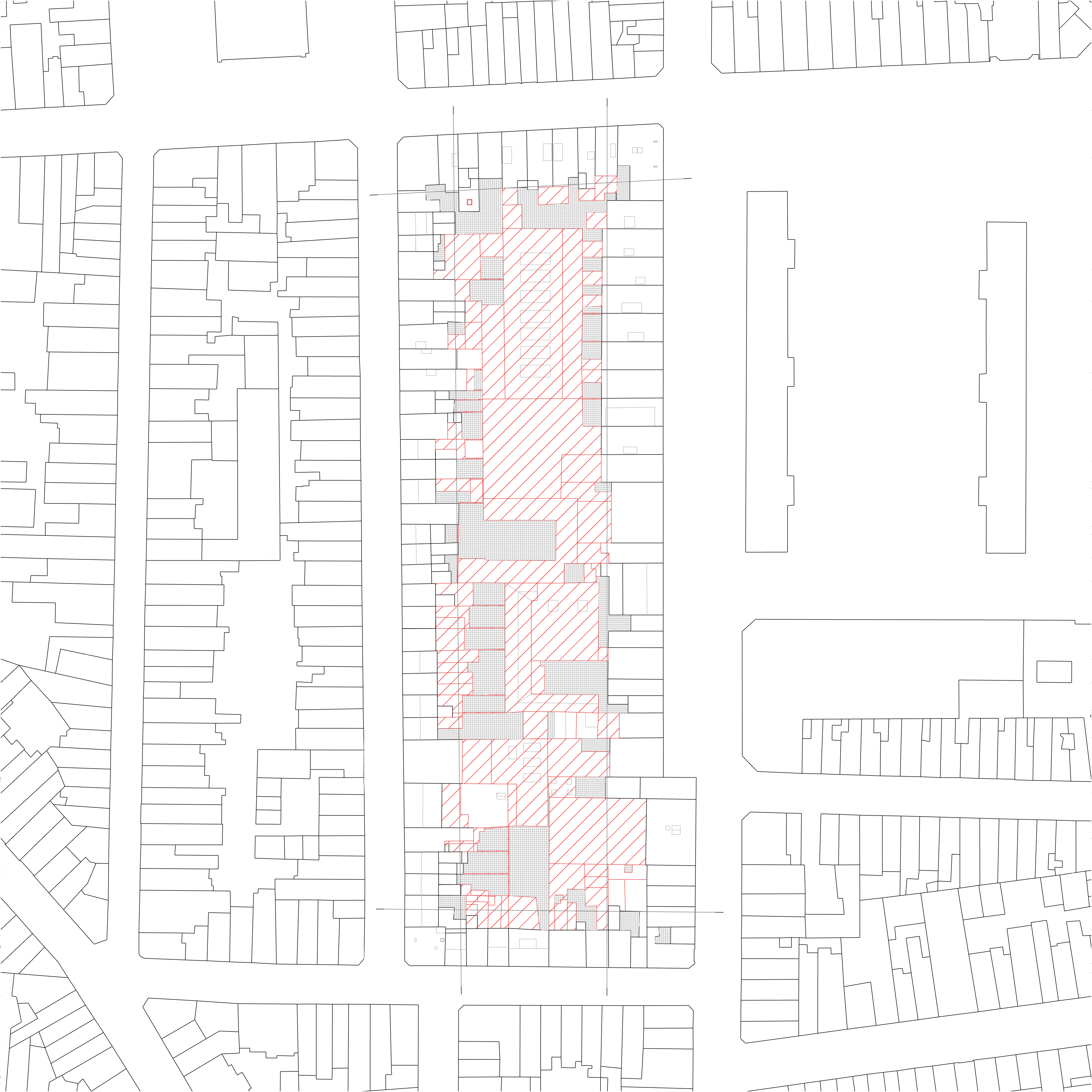
In response to the contradiction between urban development and climate collapse, thesis explores an alternative to real estate development logic of the city. Assuming circumstances resulting from class struggle, not instead of it; proposal develops protocols of cooperation, replicable across the territoy, that would see new housing and commons built/made across property lines compacting the social and economic activity. (fig 06.); while gradually removing large portions of urban sprawl (fig 07.), creating new landscapes in and around the city.
“Co-Op is an active form, governor orchestrating a (de)growth protocol and establishing a relationship between interdependent variable in the large urban calculus” (Keller Easterling, Subtractions)
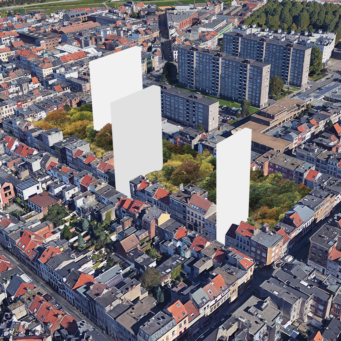
fig 06. Current population movent due to local trends coupled with climate migrants is addressed through densification of city’s block
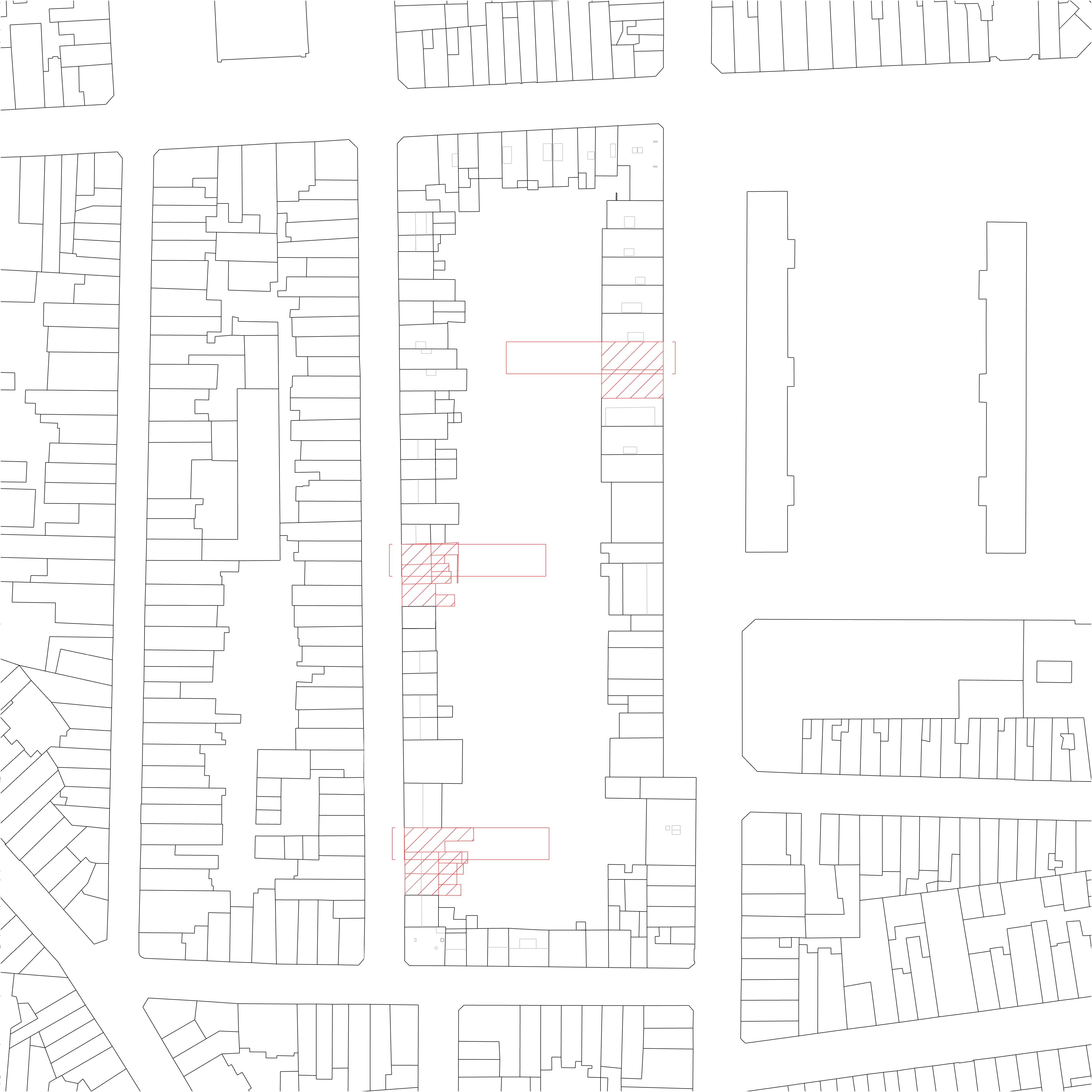
With this new paradigm established, parts of the sprawl that can not be expected to be densified successfuly or sustained in their existing form, would be taken apart and used for materials. Abandoning inadequate urban fabric would have lower cost than maintaining its status quo.
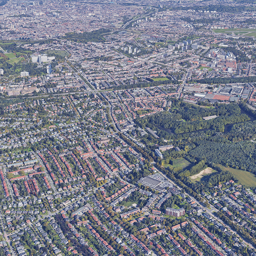 fig 07. Portions of the sprawl are removed as techologically inadequate parts of urban infrastructure
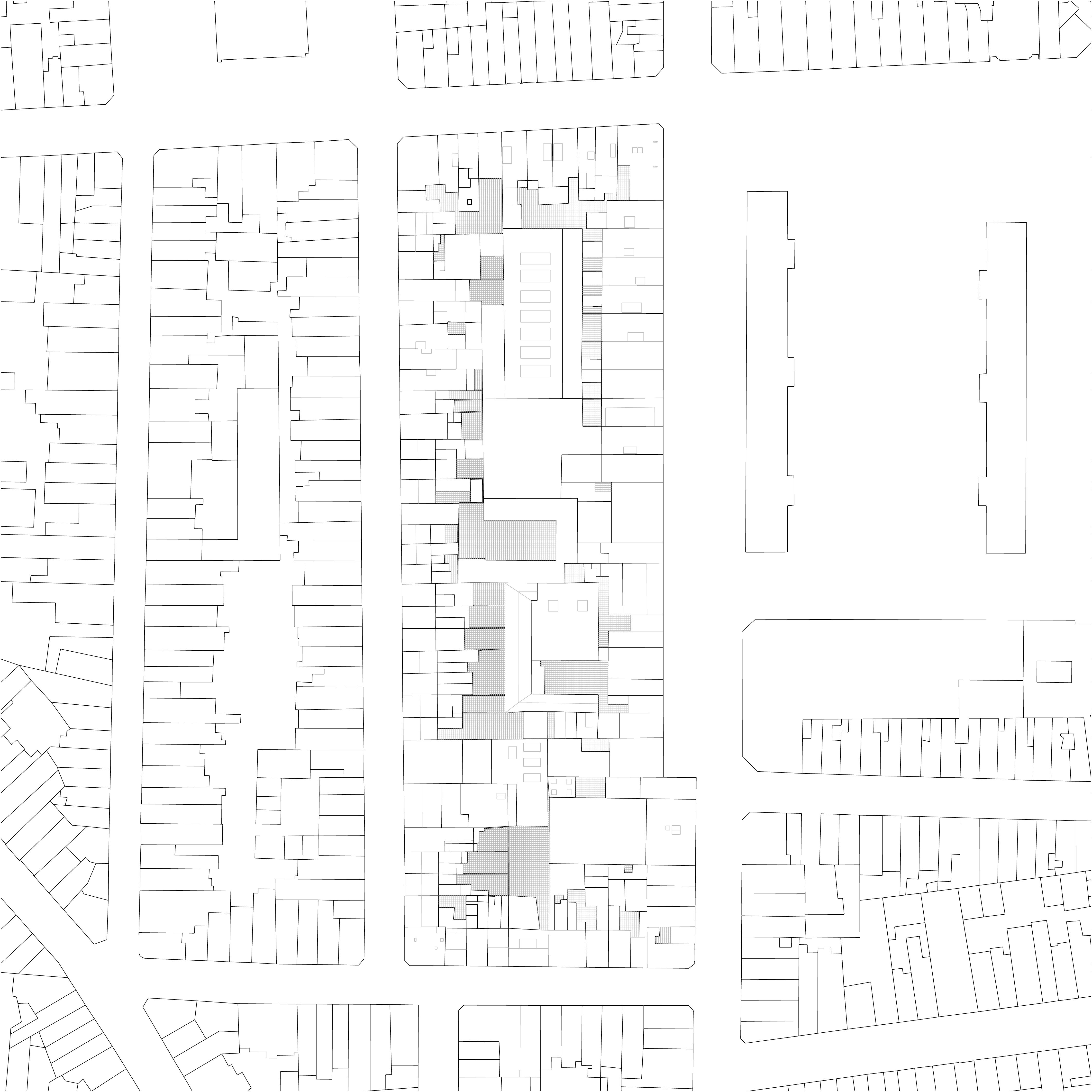
Both the processes of densification and subtraction are developed as argorithmical protocols and applied onto the scale of territory. , 500x500m grid applied over sprawl for analysis of urban proliferation; 842 primary blocks in inner city and peripheral neighbourhoods were examined for size, depth and orientation. Process of reversal would eventually see hard borded between the urban and its outside.
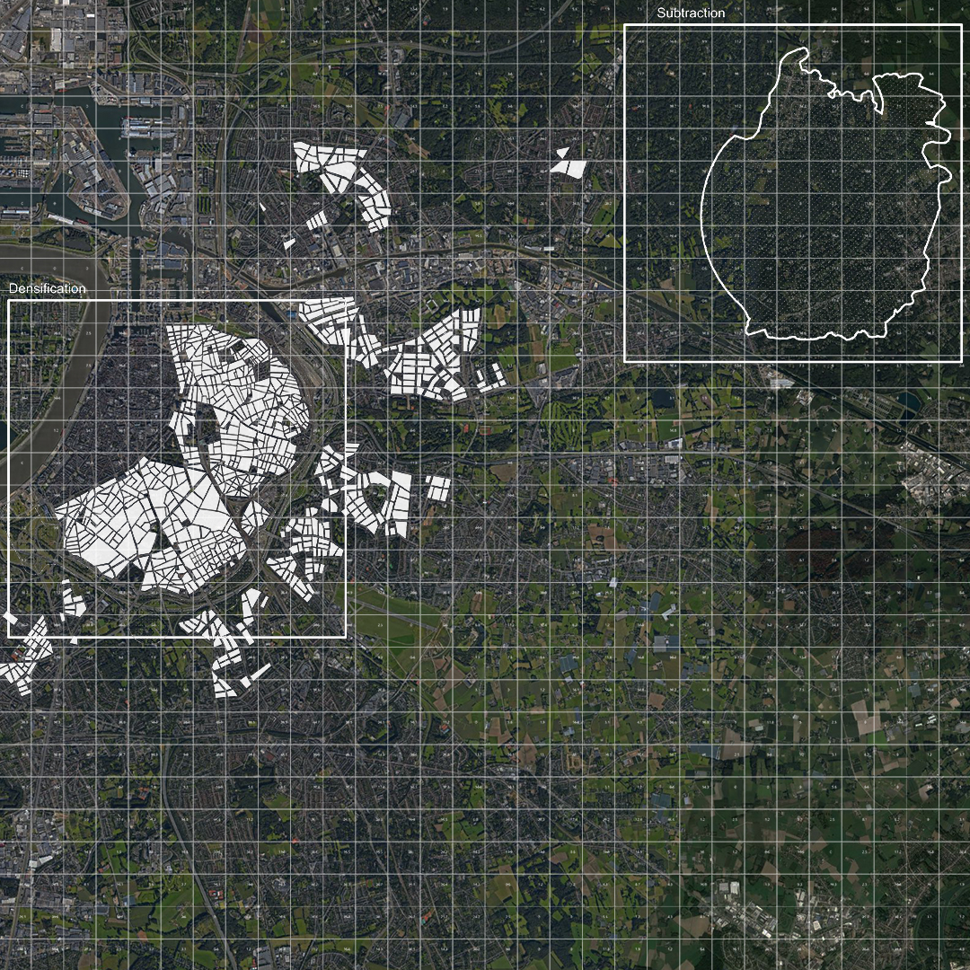 fig 08. Strategic plan
fig 09. Reversed vector of urban development
4 Density
Prefabricated and standardised new buildings (C) are anonymously plugged onto plinths (B), each plinth being bespoke and made specifically to its public function and local conditions, negotiating the contact between the alienating presence of the repetitive product and its immediate context. Newly emptied interior of the block (A) offers open green spaces and public amenities.
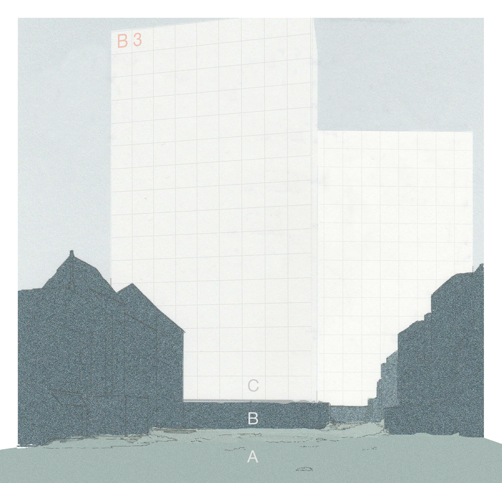 fig 10.View of the interior of the block
The main function of the building is to add capacity to the city, relieved of the identity or profit imperative, creating new commons (housing, services, spaces) inside, on top, and outside of the block’s perimeter.
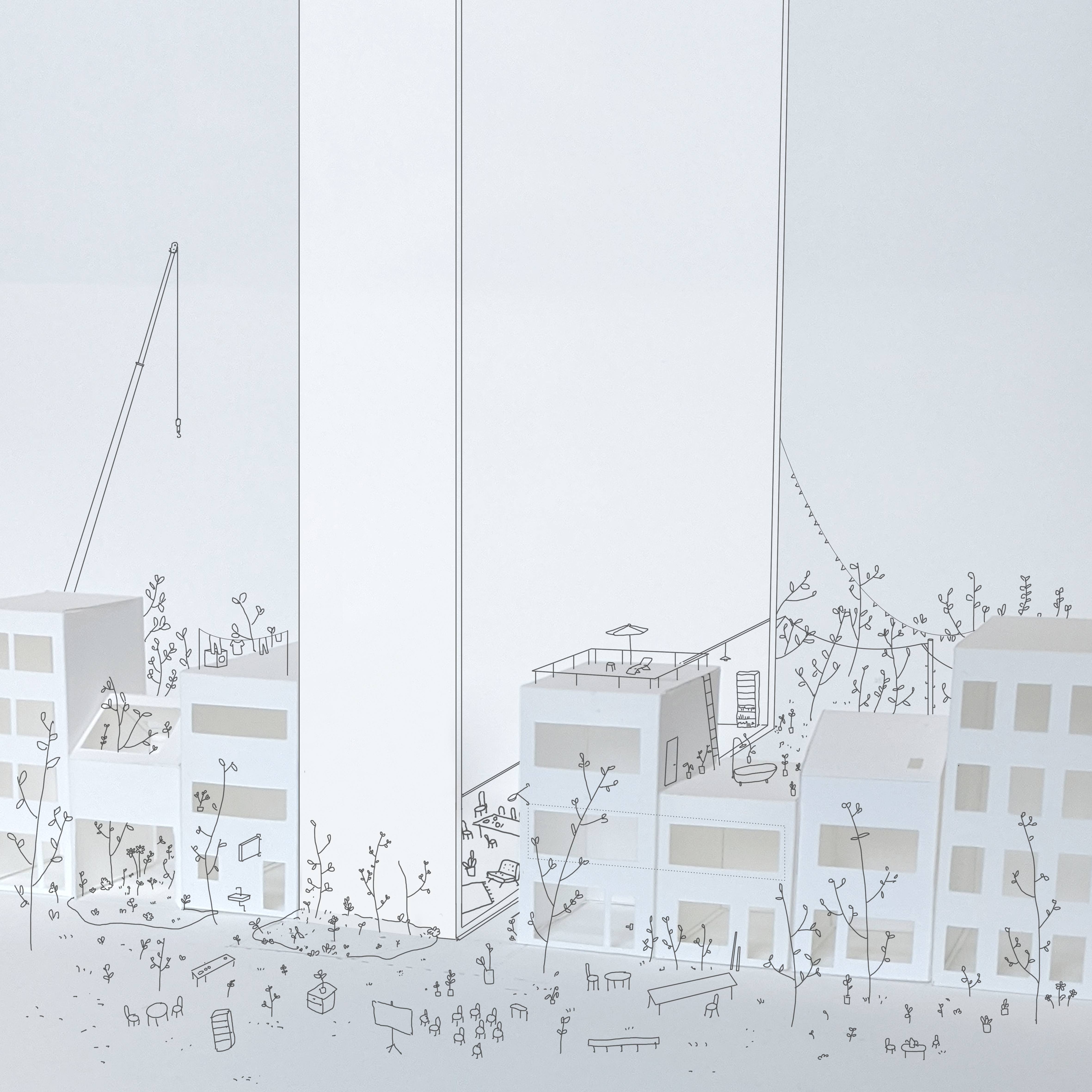
fig 11. New commons
Ultimately, proposals for new commons and public ownership of the housing are primairly in face of mitigating climate collapse, and building community resilience, creating additional stock to house climate migrants. A country with industrial and colonial past such as Belgium should do at least that much.
Pursuing economy of scale, imperative is for this new device to be repeated as often as possible. In order to do so, protocol is devised to inspect the street fronts of 842 blocks; with each individual front examined for minimum lenght, angle to south facing, and depth to the other side of the block.
 fig 12.
Diagram of constraints and data inputed in Grasshopper
fig 12.
Diagram of constraints and data inputed in Grasshopper fig 13.
Densities are tested with evolutionary solver in Grasshopper in order to find optimal dispositions of new buildings and their specific heights, with each step tested informing the optimal (densest)
fig 13.
Densities are tested with evolutionary solver in Grasshopper in order to find optimal dispositions of new buildings and their specific heights, with each step tested informing the optimal (densest)  Fig 14.
Plan of densification is not definitive and each block and plot should be revauluated on a case to case basis. Plan shown here, if using at 31% of buildings would house 132,296 people
Fig 14.
Plan of densification is not definitive and each block and plot should be revauluated on a case to case basis. Plan shown here, if using at 31% of buildings would house 132,296 people
Buildings themselves are simple prefabricated structures made with CLT elements and reused/reclaimed materials/equipment from the process of subtraction. They scale by multiplication of cells that are connected privately via south facing sunroom and publicly via gallery.
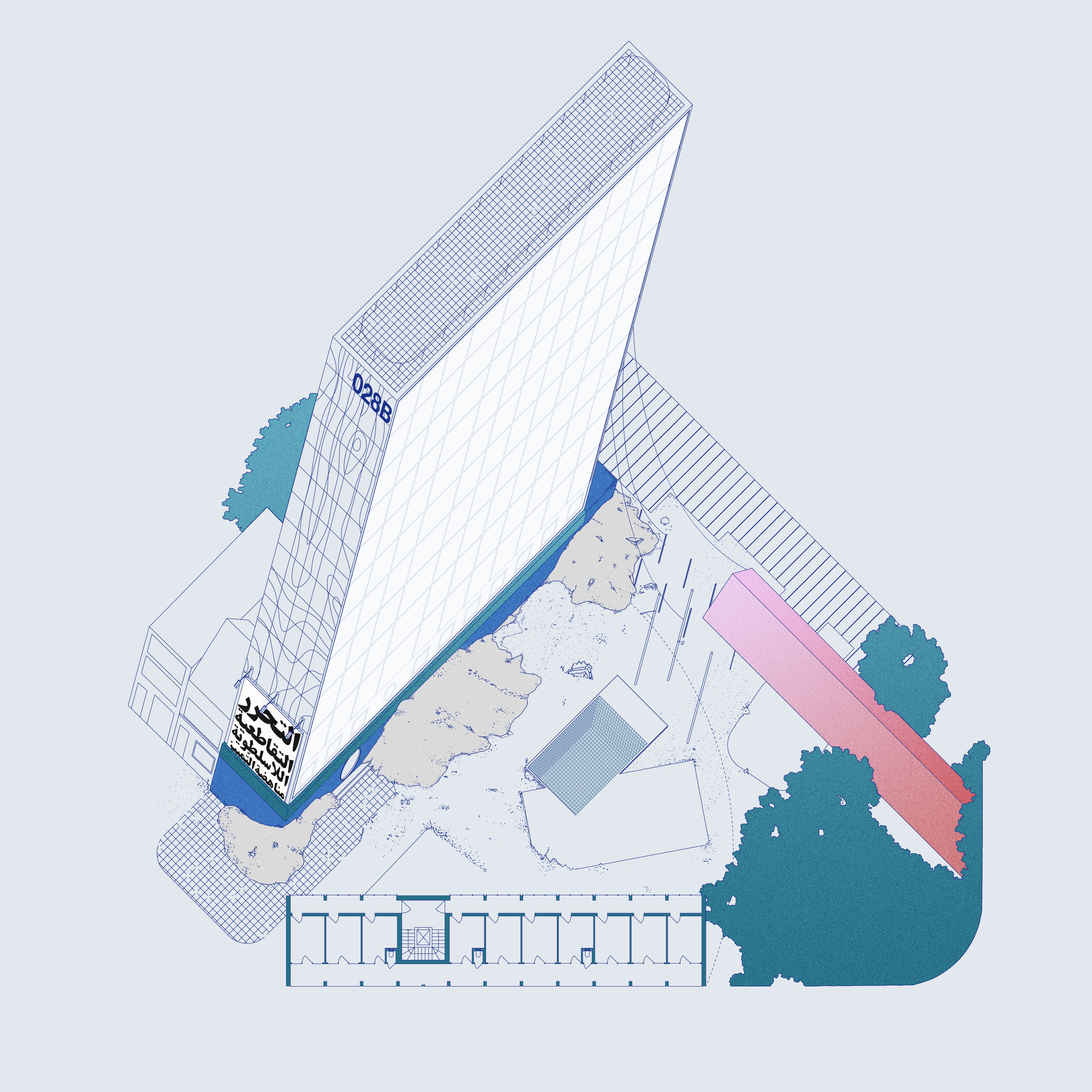 Fig 15. Device
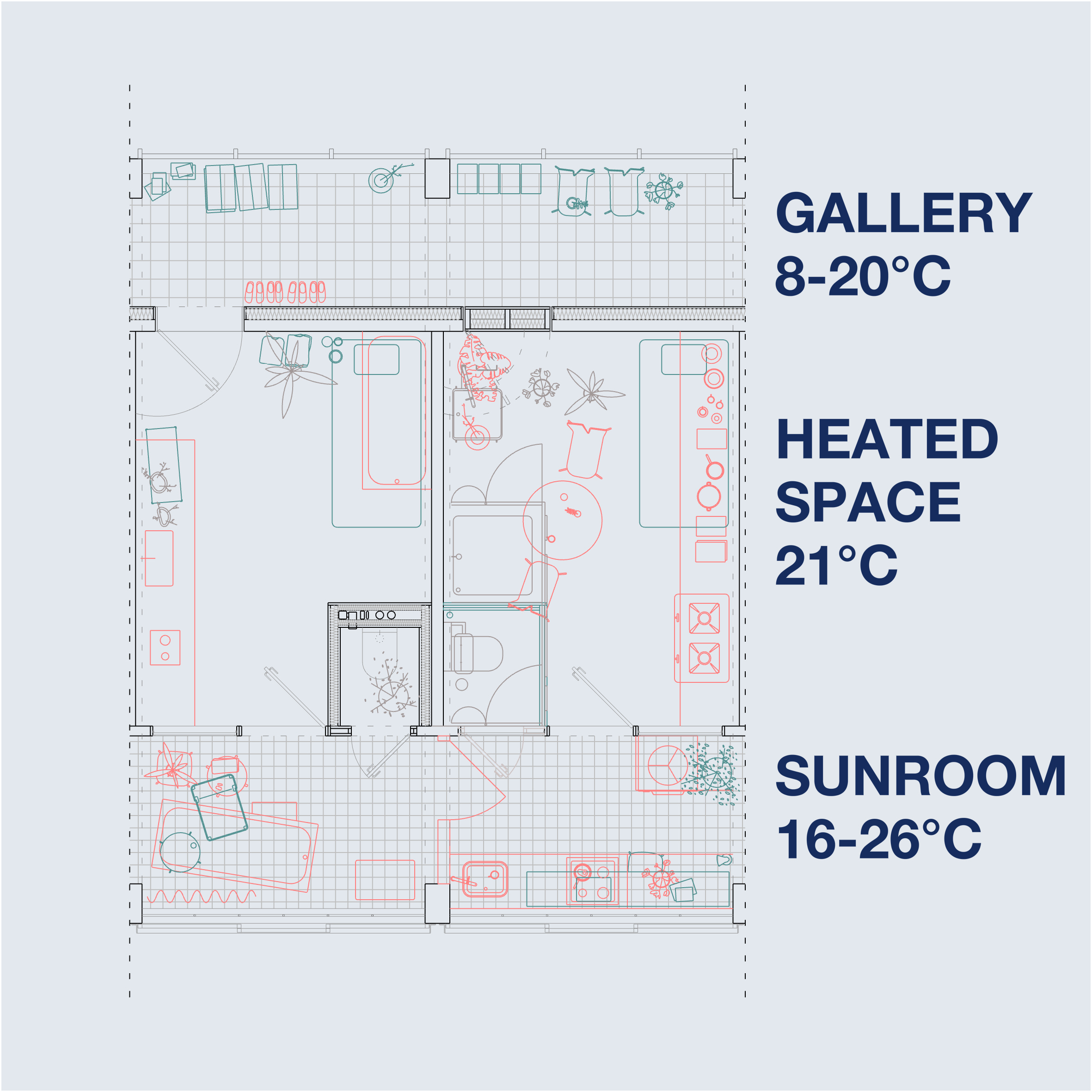 Fig 16. Cell
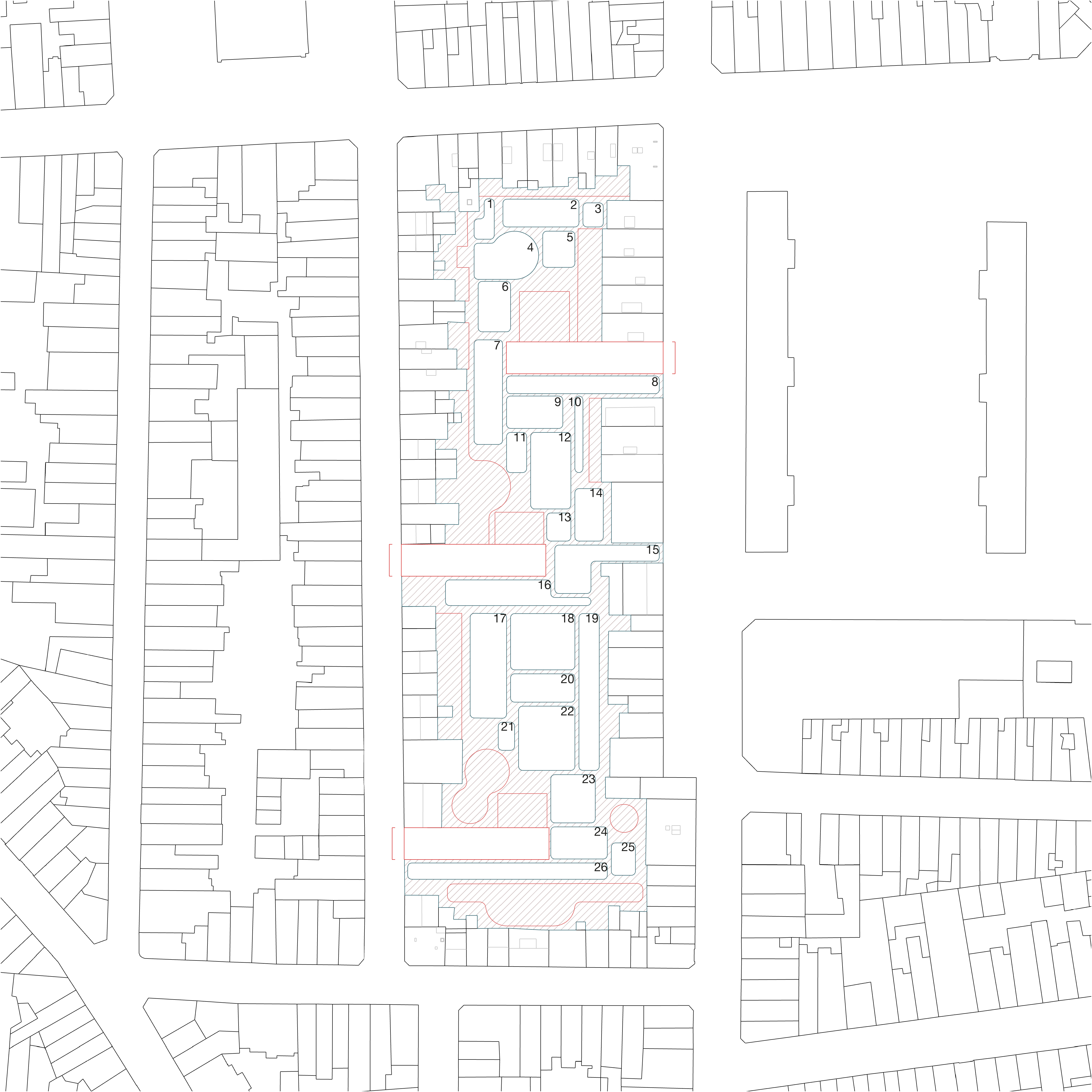
Case Study
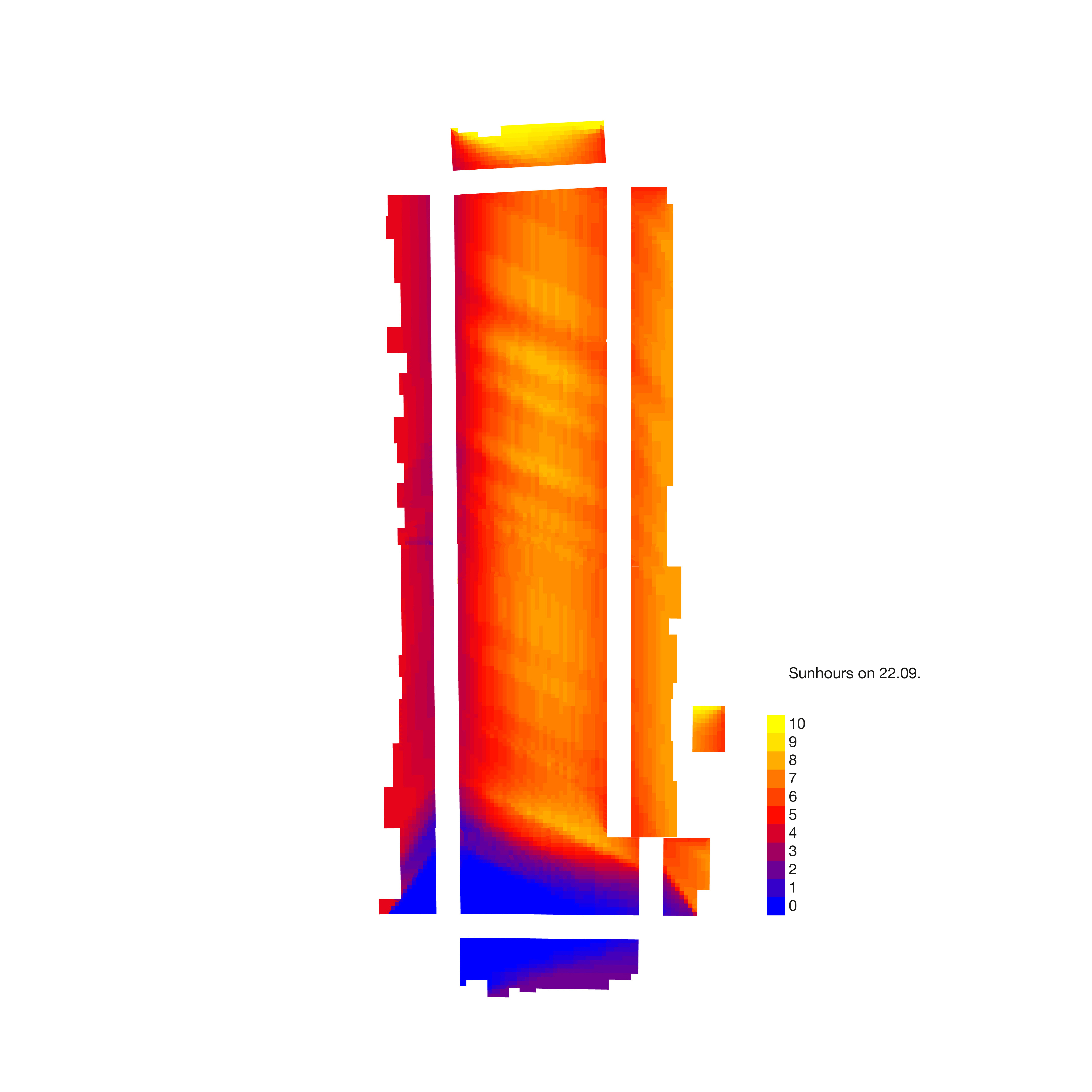
Site specific case study examined the block located on 51°13’29.92”N 4°25’30.46”E by taking the plots and heights suggested by the protocol and developing programs around this parameters, additionally considering available sun radiation in the interior of the block.
(below: image gallery, fig 17-25)


7 Subtraction
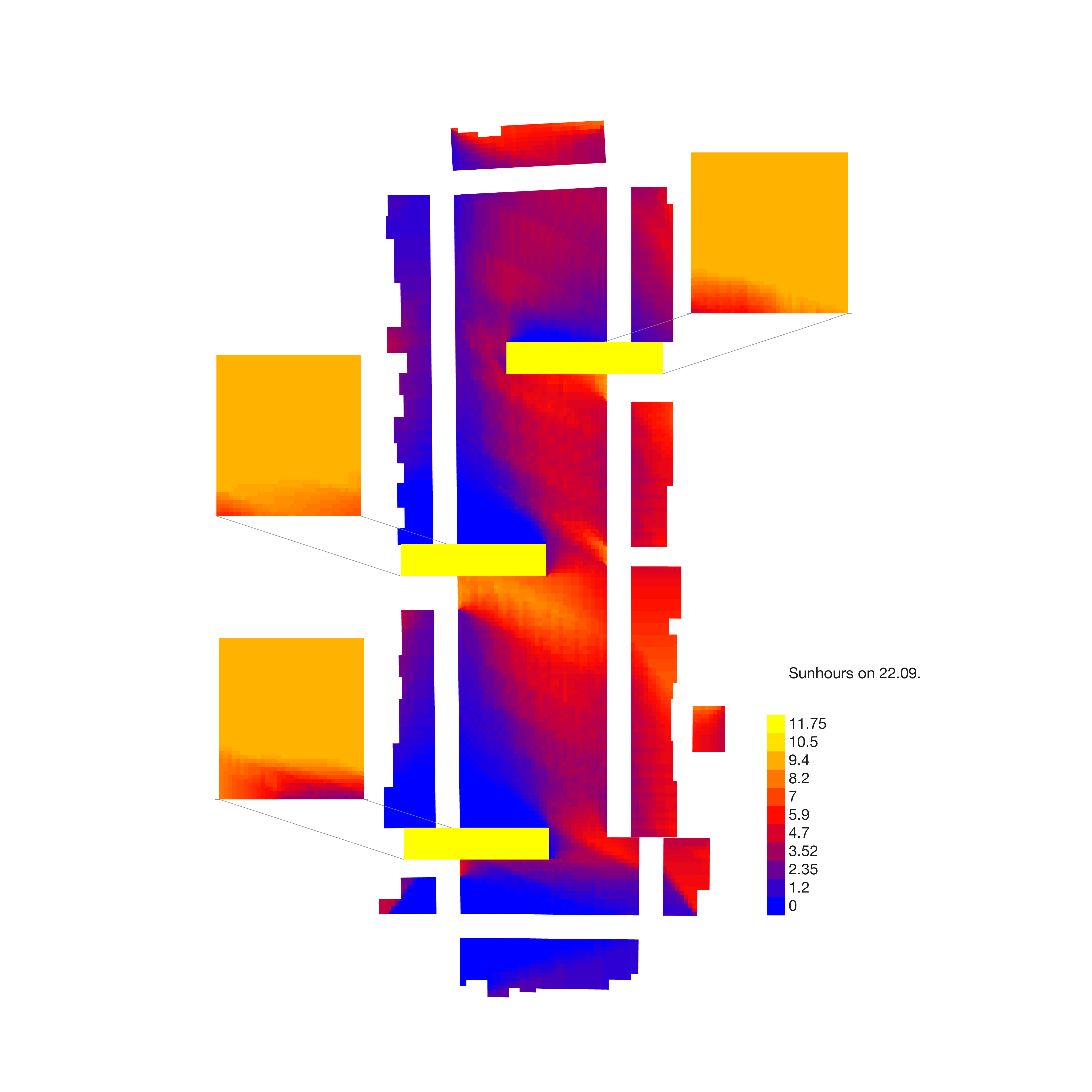
Process of subtraction uses the method of weighted urban proliferation to determine levels of sprawl over a vast area. The method itself presents only a numeric value and as such was coupled with additional assesment of data regarding population, income, and habits.
Fig 27. Territory with assigned WUP values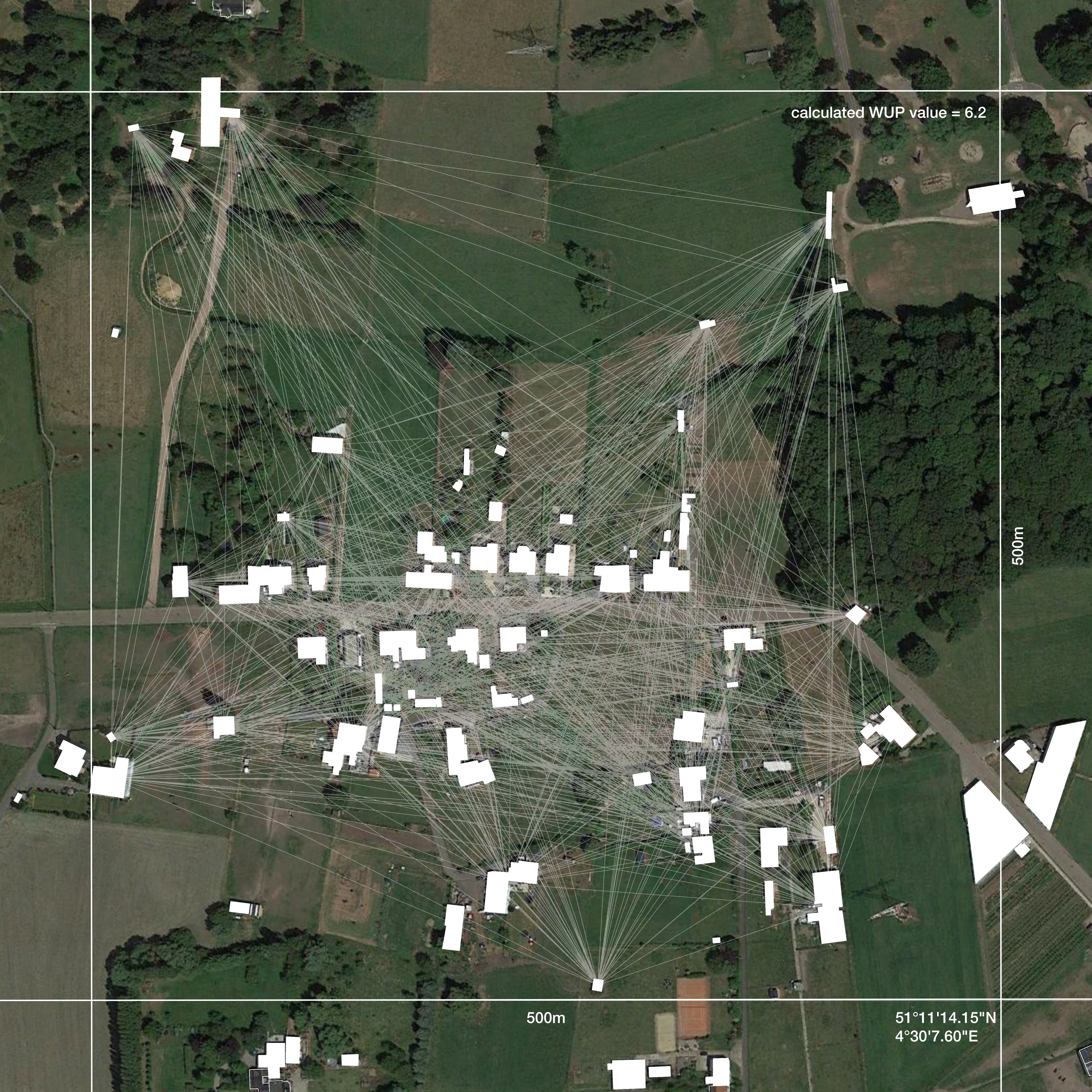 Fig 28. Each pixel is analysed for number of occuapnts, used area, and distances between buildings. Calculated WUP value indicated level of sprawl.
The process of subtraction itself comprises of two key elements: phasing of works and disposal of surplus waste (primarily crushed aggregate).
(below: image gallery Fig 29.-32.)
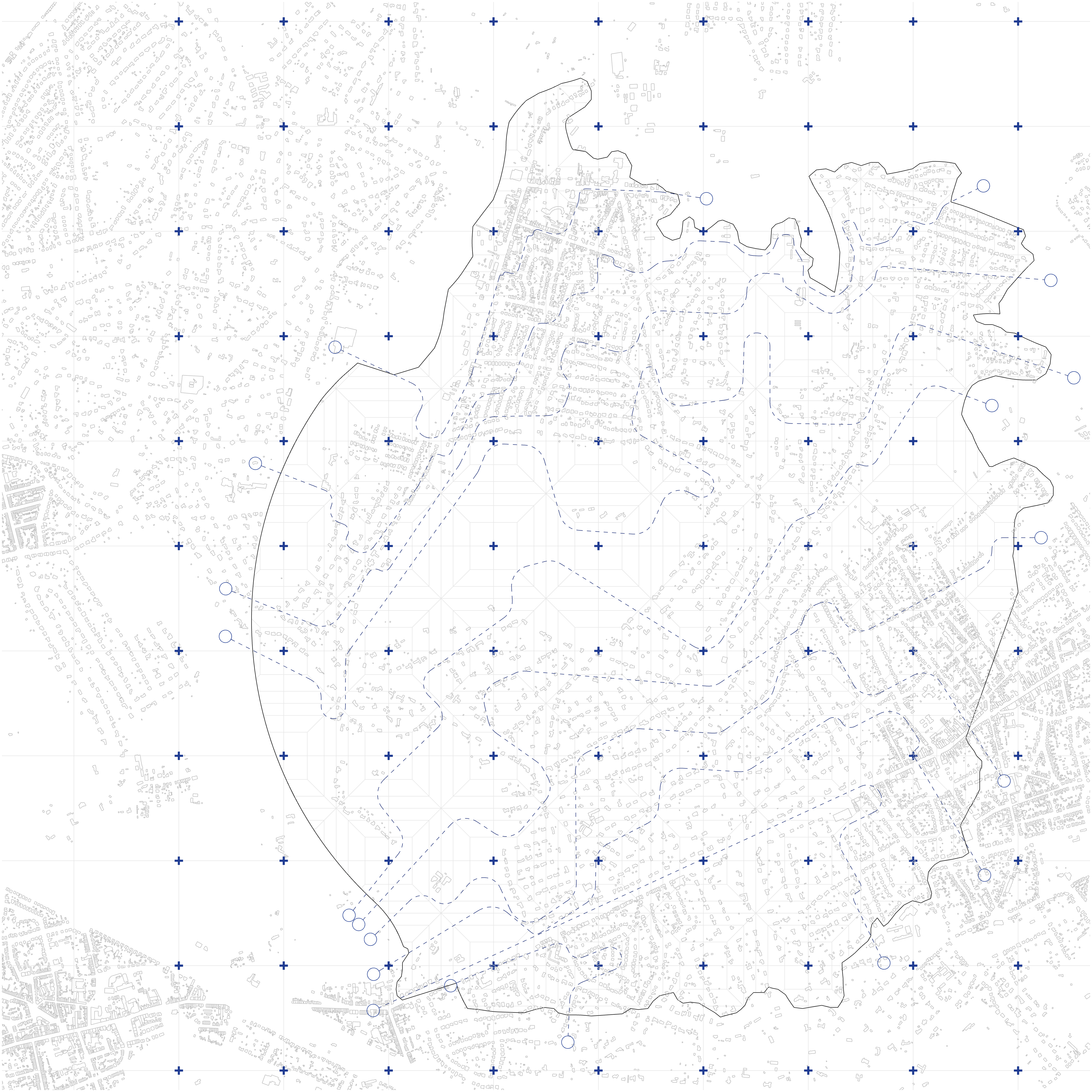
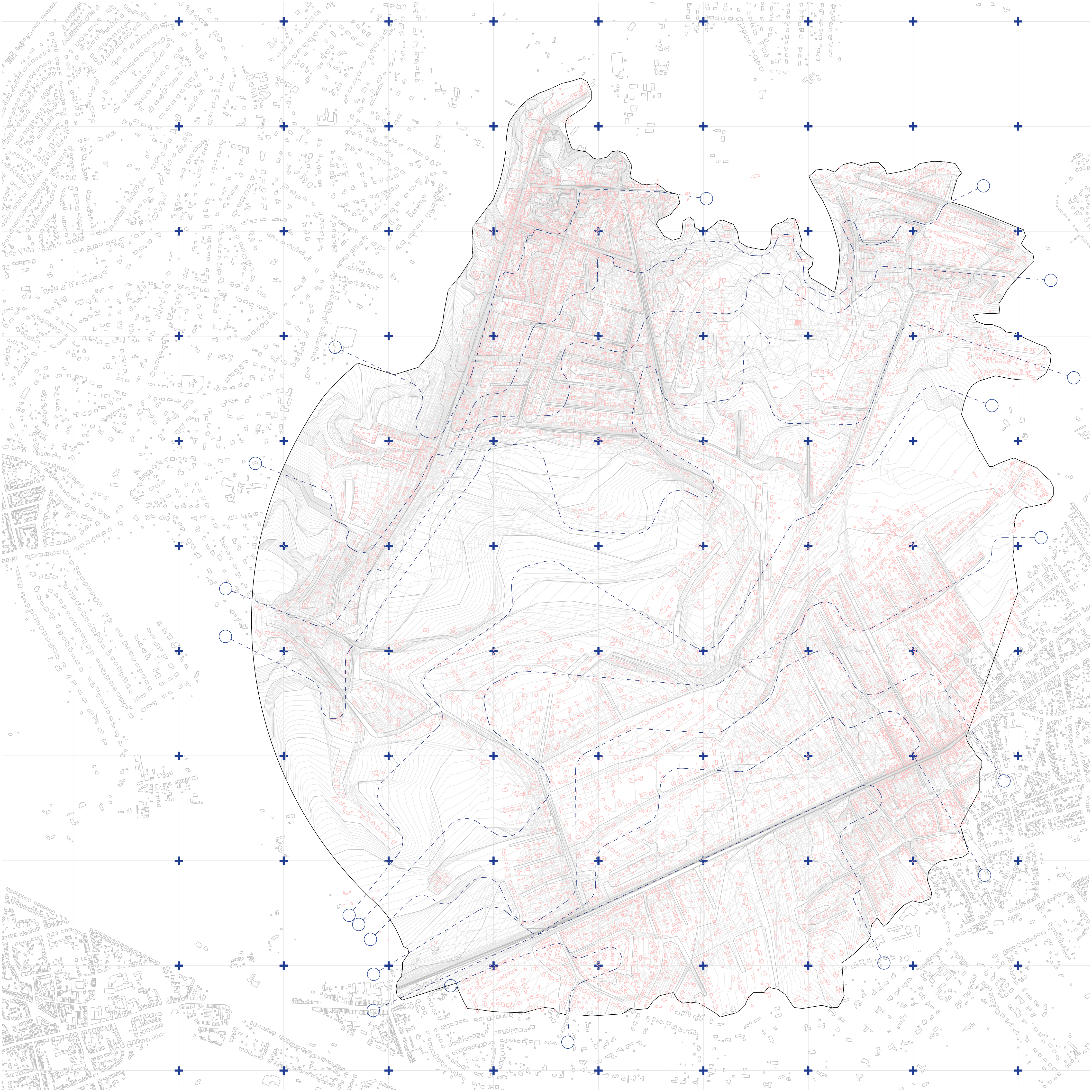
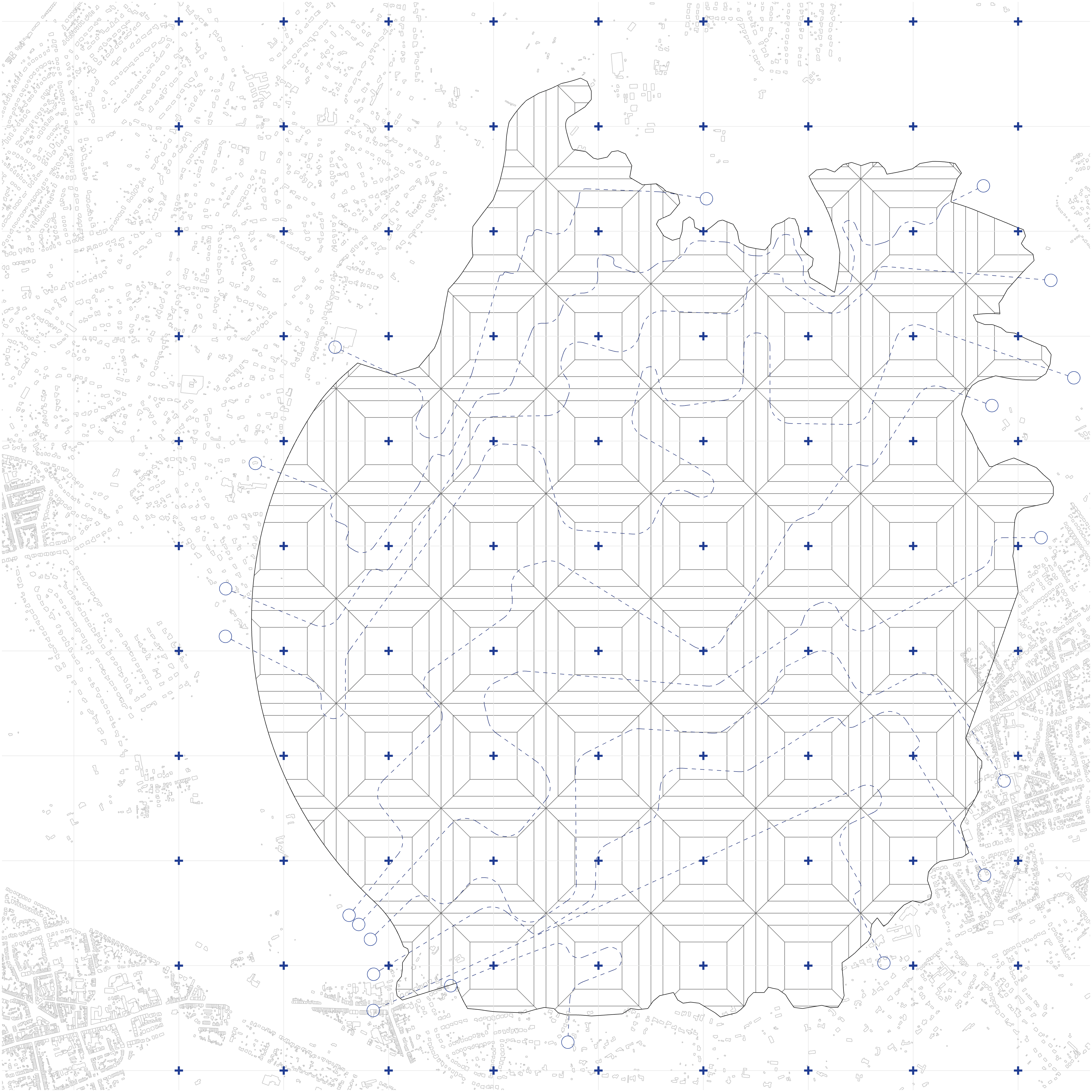
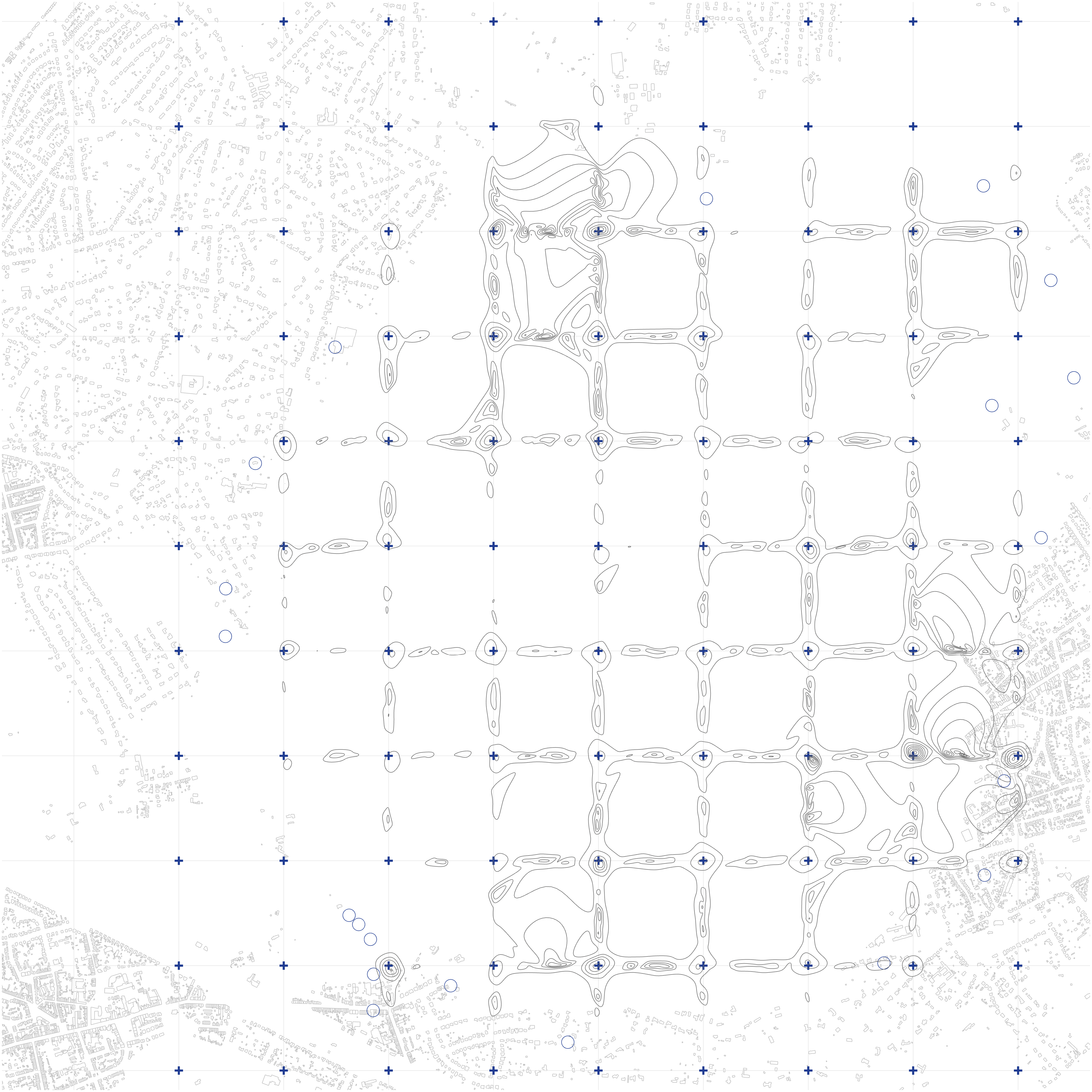
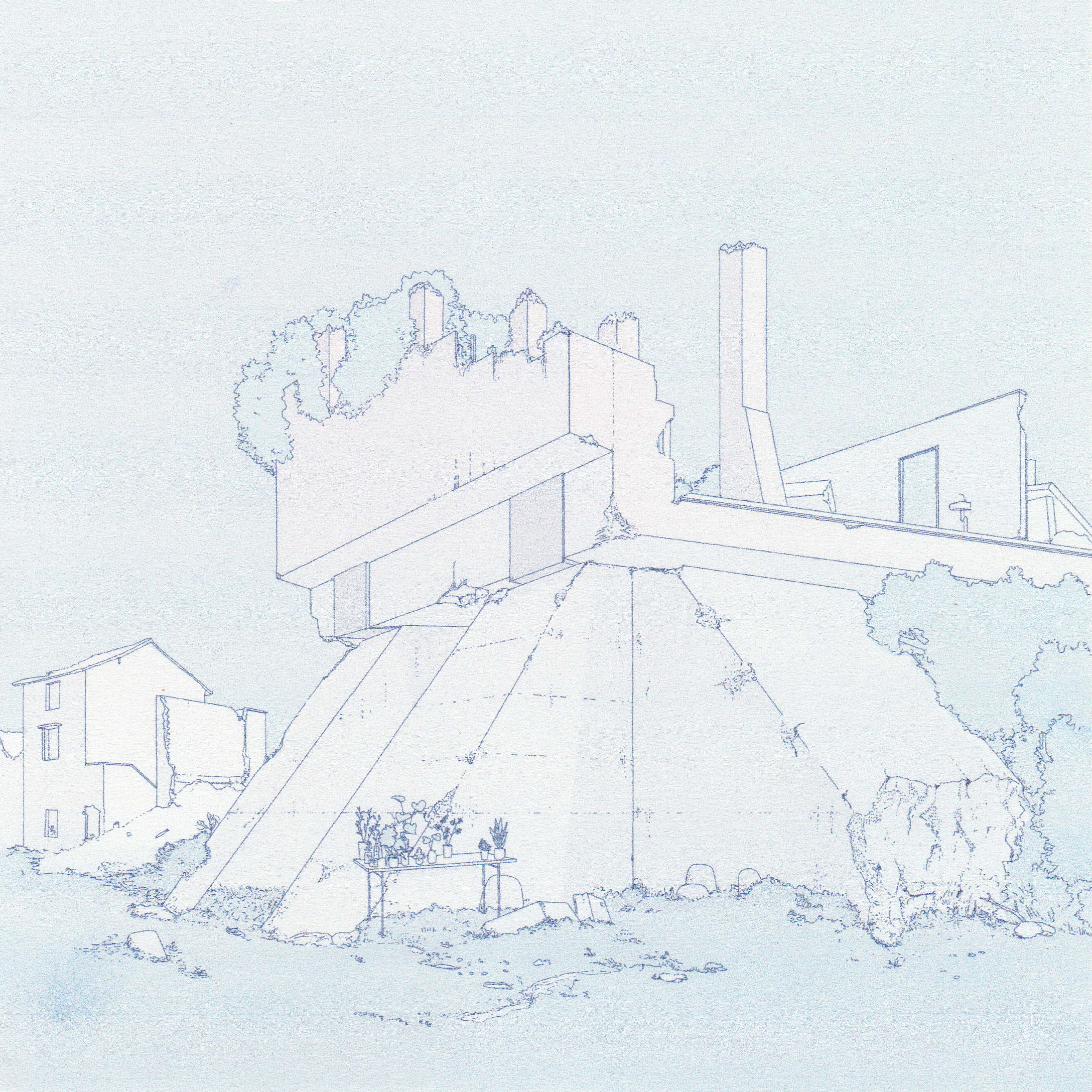 Fig 34. It can be expected that the processes of densification and subtraction will eventually meet